
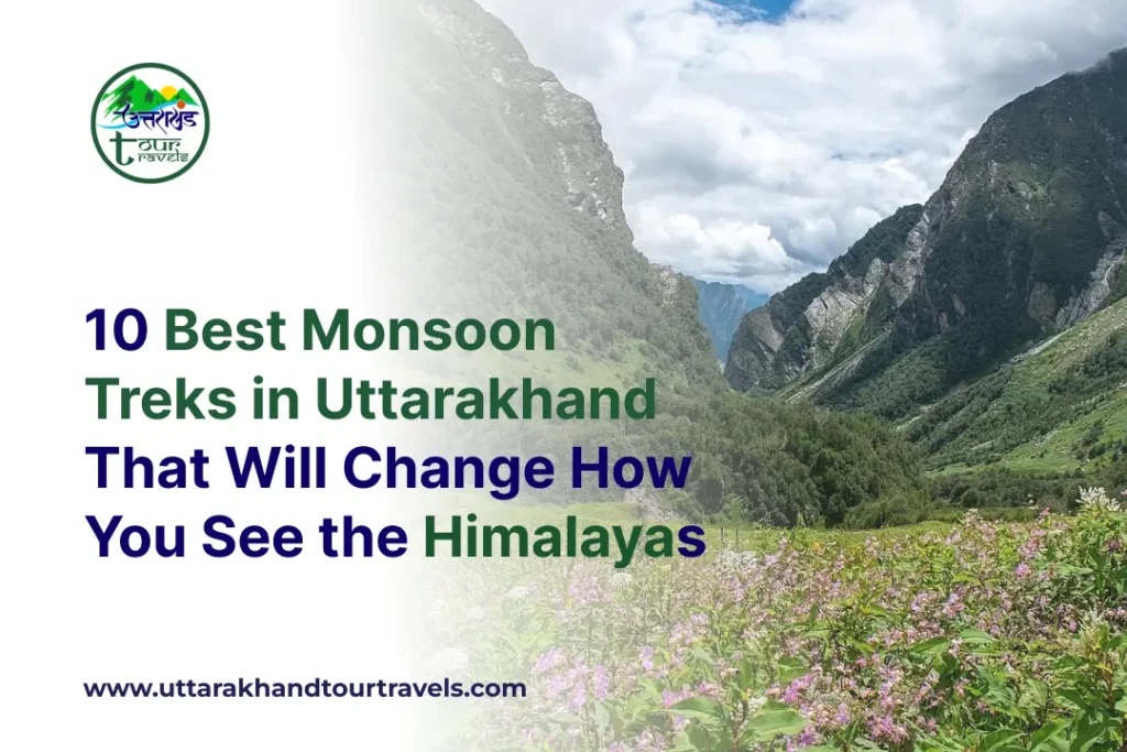
Most people treat the monsoon as the off-season for Himalayan trekking. They wait for September skies and October clarity. And in doing so, they miss something irreplaceable.
Between July and September, Uttarakhand transforms. The alpine meadows bugyals burst into colour. 500+ species of wildflowers bloom simultaneously in valleys that are bare in every other season. Waterfalls that don’t exist in May thunder down cliff faces. Forests that were dusty and sparse in April become dense, dripping, intensely alive. The air, washed clean by daily showers, carries the scent of Himalayan herbs.
Yes, trails are wetter. Yes, some routes carry risk. But the trekkers who come in the monsoon see what the others only photograph in someone else’s pictures. This guide covers the 10 best monsoon treks in Uttarakhand for 2026 with everything you need: difficulty, distance, best timing, what to expect on the trail, and the essential safety knowledge to do it right.
All 10 Monsoon Treks Quick Comparison
| # | Trek Name | Region | Distance | Max Altitude | Difficulty | Best Window | Duration |
|---|---|---|---|---|---|---|---|
| 1 | Valley of Flowers | Chamoli | 38 km | 3,658 m | Moderate | Jul – Sep | 5–6 days |
| 2 | Nag Tibba | Tehri Garhwal | 6–7 km | 3,050 m | Easy | All year | 2 days |
| 3 | Dayara Bugyal | Uttarkashi | 22 km | 3,639 m | Easy–Mod | Jul – Aug | 3–4 days |
| 4 | Har Ki Dun | Uttarkashi | 25 km (one-way) | 3,600 m | Moderate | Mar–Jun, Sep–Dec | 5–7 days |
| 5 | Kush Kalyan Bugyal | Tehri Garhwal | 35 km | 3,838 m | Moderate | Jul – Sep | 5–6 days |
| 6 | Sahastra Tal | Uttarkashi | 45–65 km | 4,750 m | Difficult | Aug – Oct | 8–9 days |
| 7 | Dodi Tal | Uttarkashi | 20 km | 3,024 m | Moderate | Monsoon & Winter | 3–4 days |
| 8 | Gidara Bugyal | Uttarkashi | 33 km | 4,240 m | Mod–Difficult | Jul – Sep | 5–8 days |
| 9 | Roopkund | Chamoli | 53 km | 5,029 m | Difficult | Early Jul only | 8 days |
| 10 | Kedarkantha Base | Uttarkashi | 18 km | 3,100 m | Easy | Jul – Aug | 2–3 days |
1. Valley of Flowers
There is no more perfect monsoon trek in India than the Valley of Flowers. This is not a seasonal preference; it is literally only accessible and only meaningful during the monsoon months. The valley is shut the rest of the year. And when it opens in June, it spends the next three months doing something no other place on Earth quite replicates: deploying over 500 species of Himalayan wildflowers in a concentrated 87 sq km hanging valley that sits at 3,500 metres above sea level.
Declared a UNESCO World Heritage Site in 2005 and part of the Nanda Devi Biosphere Reserve, the Valley of Flowers was discovered by British mountaineer Frank Smythe in 1931 entirely by accident, when his team lost their way after a failed summit attempt. He was so overwhelmed that he named it on the spot. Nothing has changed about the magic since.
The trek begins from Govindghat, 18 km from Joshimath on the Badrinath route. From Govindghat, you walk or take a shared vehicle to Pulna, then hike to Ghangaria (the base village), and spend the following days exploring the valley itself and, if you choose, the sacred Hemkund Sahib Gurudwara at 4,329 m.
Peak bloom window: mid-July to mid-August. This is when the valley is at its absolute most spectacular. Brahma Kamal (the sacred Himalayan lotus), Blue Poppy, Cobra Lily, Himalayan Bellflower, Primulas, Anemones, Marsh Marigolds, and dozens of rare orchid species bloom the entire valley floor, a living mosaic of colour.
🌸 Why Monsoon is the ONLY Time to Visit: The Valley of Flowers does not exist in the same way in any other season. The monsoon rains are the direct trigger for this floral explosion. Come in May, and you see rocky slopes. Come in July, and you see one of the most extraordinary natural spectacles on the planet.
- 500+ alpine flower species, including the sacred Brahma Kamal, Blue Poppy, Himalayan Balsam, Wild Roses, Rhododendrons, Larkspur, Monkshood, and rare rock ferns
- Wildlife in the valley includes the Snow Leopard, the Asiatic Black Bear, the Red Fox, the Himalayan Monal, the Blue Sheep, and the Flying Squirrel
- Panoramic views of Gauri Parvat, Nilgiri, Nanda Devi, and Dunagiri on clear days
- Option to combine with Hemkund Sahib, the world’s highest Sikh Gurudwara at 4,329 m, beside a glacial lake surrounded by seven peaks
- Well-maintained stone-paved trail from Govindghat to Ghangaria is manageable even for beginners despite monsoon conditions
- UNESCO World Heritage Site since 2005, one of the planet’s most biodiverse alpine zones
⚠️ Monsoon Note: Trails between Govindghat and Ghangaria can become slippery after heavy rain. Start early, before 7 am, to complete the approach before afternoon showers intensify. A guide is highly recommended. River crossings must be assessed carefully.
2. Nag Tibba – Serpent’s Peak
For city-dwellers who want to experience Uttarakhand’s monsoon magic without a multi-day expedition commitment, Nag Tibba is the answer. Just 3 hours by taxi from Dehradun, Pantwari village is home to the highest peak in the lower Himalayan ranges of Garhwal and one of the most rewarding two-day treks in the country, regardless of season.
In the monsoon, Nag Tibba becomes something special. The dense forests of oak, rhododendron, and pine that line the trail absorb the rain and release it back as mist. You hike through a canopy of fog so thick you feel as if you’re wrapped inside the mountain. Then, on the rare clear stretch, the tree canopies appear beneath you, a sea of green rolling toward the valley below. On summit day, when visibility opens, you’re rewarded with a 360° view that includes Swargarohini, Kalanag, Gangotri, Bandarpoonch, and Kedarnath peaks.
The trail is mostly a gradual ascent with a steep final 1.5 km section. Even in monsoon, the lower gradient makes this one of the most accessible Himalayan treks for beginners, families, and those returning to trekking after a break.
Mythological significance: Nag Tibba translates to “Serpent’s Peak.” The summit is considered the abode of the Lord of Serpents, and on festivals like Nag Panchami, local villagers make the climb to worship Nag Devta, a tradition that has continued for centuries.
- Misty, cloud-wrapped forests create an ethereal monsoon atmosphere unique to this season
- Panoramic summit views of Swargarohini, Kalanag, Gangotri, Bandarpoonch, and the Kedarnath range on clear days
- Dense coniferous forest canopy is ideal for birdwatching and wildlife spotting
- Strong connection to Hindu mythology, the Nag Devta temple at the summit is actively worshipped
- Easy difficulty makes it perfect for families, beginners, and first-time monsoon trekkers
3. Dayara Bugyal
Dayara Bugyal is the kind of place that makes you reconsider everything you thought you knew about Indian trekking. Most people know it as a winter trek; the snow-covered meadow photographs beautifully in December. What most people don’t know is that the monsoon version is equally extraordinary and, in many ways, more alive.
When the rains arrive, Dayara undergoes a dramatic metamorphosis. The vast alpine meadow at 3,639 m, one of India’s largest bugyals, fills with wildflowers. Rhododendrons that were bare branches in May explode into colour. The approach through giant Deodar and Oak forests, already dramatic in summer, takes on the quality of a fairy tale in the monsoon: dripping, lush, the path soft underfoot, the air sharp and sweet.
From the meadow on a clear day, the views are staggering: Draupadi ka Danda, the Gangotri range, Jaonali Peak, and Bandarpoonch all visible from the expanse of grass and flowers. If you’re lucky, a flock of Himalayan sheep will be grazing nearby; the shepherds bring their flocks here in summer, adding a timeless pastoral quality to the scene.
The Dayara Bugyal is also celebrated for the Butter Holi (Anduri Festival), an ancient local tradition held in April, where villagers use butter and buttermilk instead of colours. It’s one of the most unusual festivals in the Himalayas, still practised today.
- One of India’s largest alpine meadows, with spectacular scale and open views from the summit plateau
- Wildflowers carpet the bugyal in the monsoon. Rhododendrons, Brahma Kamal, Himalayan Daisy, and dozens of rare species
- Trail through towering Deodar and Oak forest, one of the finest forest walks in Uttarakhand
- Views of Draupadi ka Danda, Gangotri Range, Srikanth, and Bandarpoonchon on clear days
- Himalayan sheep herds in the bugyal during summer are a rare, peaceful pastoral scene at altitude
- Easy-moderate difficulty makes it accessible for families and trekkers of all fitness levels
4. Har Ki Dun – Valley of the Gods
Har Ki Dun, the Valley of the Gods, is one of the most storied treks in the entire Himalayan range. The name itself translates to “valley held by gods,” and the entire route carries this mythological weight: ancient wooden villages still following Jaunsari and Garhwali traditions, temples believed to be directly connected to the Mahabharata, and a landscape that hasn’t meaningfully changed in centuries.
From Sankri, the trail follows the roaring Supin River through a succession of unique waypoints: Taluka, Gangarh, Dhatmeer, Osla, and finally the open meadow of Har Ki Dun itself. In monsoon, the Supin runs with incredible force, a milky blue-white torrent that you walk alongside for much of the approach. The sound is constant, powerful, and oddly calming.
The valley lies within Govind Pashu Vihar Wildlife Sanctuary, one of Uttarakhand’s most biodiverse protected areas. Beyond the valley, the high-altitude Marinda Tal lake sits quietly, one of those rare monsoon destinations that few trekkers reach.
- Ancient Himalayan villages – Osla and Seema preserving 3,000-year-old wooden architecture and Jaunsari culture
- Mythological connection: the village of Osla has a temple believed to be where the Pandavas rested during their passage to heaven
- Views of Swargarohini, Bandarpoonch, Kalanag, and Black Peak from the valley
- The Supin River in monsoon a dramatic blue-white torrent alongside your trail for much of the approach
- Marinda Tal – a serene high-altitude lake accessible as a day-hike extension from the main valley
- Exceptional birdwatching: Govind Pashu Vihar is home to rare Himalayan avifauna
5. Kush Kalyan Bugyal
Kush Kalyan is the trek for those who want Uttarakhand’s monsoon magic without the crowds. While Valley of Flowers draws thousands of visitors between July and September, Kush Kalyan receives a fraction of that footfall yet delivers a bugyal experience that is genuinely comparable in visual drama.
The trail starts from Silla Village and climbs through oak forest, the Chuli La pass, and interior ridge terrain to reach the vast meadow at 3,838 m, a natural amphitheatre of alpine grass and flowering herbs ringed by Himalayan peaks. In monsoon, the entire bugyal becomes a living pharmacy: Cobra Lily, Himalayan Daisy, Blue Poppy, Rhododendron (Buransh), Thuner and Moor grow in concentrated abundance, some of them medicinal plants of significant value.
This route holds a fascinating piece of Himalayan history. It sits on the ancient pilgrimage trail between Gangotri and Kedarnath, used by devotees for centuries before motorable roads made the modern routes possible. Local deity temples and traditional Chhanis (herder huts) are scattered along the route, and the herders who bring their cattle here in summer still offer hot meals and basic accommodation to passing trekkers, one of those rare, intimate Himalayan hospitality experiences that is becoming increasingly hard to find.
- Remote bugyal trek with far fewer crowds than Valley of Flowers, genuine solitude in monsoon
- Rare medicinal flora, including Cobra Lily, Blue Poppy, Himalayan Daisy, and dozens of endemic species
- The ancient pilgrim trail between Gangotri and Kedarnath has historical and spiritual depth on every section
- Local herder hospitality Chhani owners offer meals and basic stays along the route
- Wildlife, including Himalayan Black Bear, Bharal, Ibex, Musk Deer, Snow Leopard, and Tahr
- Views of the Gangotri and Kedarnath ranges from the summit bugyal plateau
6. Sahastra Tal – The Lake of Gods
For trekkers seeking something truly extraordinary, an expedition-grade monsoon trail to one of the most remote and mythologically significant lakes in the Himalayas, Sahastra Tal is the answer. Positioned between the Balganga Valley in the west and the Bhilangana Valley in the east, this high-altitude lake at 4,750 m is called the Lake of Gods for good reason: it exists at the edge of the inhabited world, accessible only to those who commit to eight days of serious mountain walking.
The approach from Bhatwari (28 km from Uttarkashi) passes through Silla Village, Gairi, Kush Kalyan Bugyal, and Kyarki before reaching the lake. En route, you’ll see six additional glacial lakes in the surrounding area, all named after characters from the Mahabharata, and all deeply sacred to the communities of nearby villages like Thandi, Gangi, Silla, and Gairi.
In monsoon, Sahastra Tal becomes double the spectacle: the sacred Brahma Kamal and Fen Kamal bloom in dense profusion along the lake shore, a sight of extraordinary spiritual and aesthetic beauty that only occurs during these months. On a clear day, peaks like Kalanag, Jaonli, Srikanth, and Draupadi ka Danda reflect in the still water of the lake.
- Sacred Brahma Kamal and Fen Kamal bloom exclusively along the lakeshore in the monsoon, one of the Himalayas’ most spiritual natural spectacles
- Six additional glacial lakes in the vicinity are all connected to the Mahabharata mythology
- Views of Kalanag, Jaonli, Srikanth, and Draupadi ka Dandafrom the lake basin
- Active pilgrimage site for surrounding village communities, cultural depth beyond mere trekking
- Local legend: a king once offered a thousand Brahma Kamal to Lord Vishnu on this shore, hence “Sahastra” (thousand) Tal
7. Dodi Tal – Lord Ganesha’s Birthplace
Dodi Tal may not have the altitude drama of Sahastra Tal or the floral spectacle of the Valley of Flowers, but it delivers something equally powerful: a sense of deep peace. The lake at 3,024 m is ringed by tall conical conifers whose reflections in the still water create a natural landscape photograph. Behind the tree line, the curved profiles of the surrounding peaks complete the picture. In monsoon, a light mist typically sits on the water surface in the mornings, and the effect is otherworldly.
The trek starts from Agoda Village in the Barahat Range, 19–22 km north of Uttarkashi (about an hour by taxi). From Agoda, you walk through the villages of Manjhi and Bebra over two days to reach the lake. The trail is a mix of rocky path, forested sections, and steep alpine climb, challenging enough to feel like an achievement, accessible enough for moderately fit trekkers.
At the lake, a temple dedicated to Lord Ganpati Ji and Devi Annapurna sits at the water’s edge, built in traditional Pahadi (hill) architecture, with idols and paintings in vivid green, blue, red, and yellow adorning its exterior walls. The spiritual belief is that this is the very spot where Lord Ganesha was born. Many trekkers come as much for this darshan as for the natural beauty.
From Dodi Tal, two onward circuit routes are possible: the Dodital–Dayara Circuit and the Dodital Surya Top Circuit, making this an excellent base for multi-day exploration of the surrounding terrain.
- One of the most photographically beautiful Himalayan lakes, still water, conifer reflections, peak backdrop
- Temple of Lord Ganesha and Devi Annapurna at the lakeshore active pilgrimage site
- Encircled by the Bandarpoonch, Kalanag, and Swargarohini mountain ranges
- Monsoon mornings: mist sits on the lake surface, creating an ethereal, almost spiritual atmosphere
- Circuit route extensions to Dayara Bugyal or Surya Top can be combined for a longer expedition
8. Gidara Bugyal
If the thought of sharing a trail with hundreds of other trekkers diminishes the experience for you, Gidara Bugyal is your monsoon destination. This vast, largely unknown alpine meadow in the Garhwal Himalayas sits at 4,240 m and sees a fraction of the footfall of the region’s famous treks yet delivers a high-altitude landscape that is genuinely comparable to anything the region offers.
In the monsoon, the bugyal transforms into one of the most vivid wildflower meadows in Uttarakhand. The views from the upper plateau of Bandarpoonch, the Gangotri range, and Jaonli Peak are unobstructed and extraordinary on a clear monsoon morning. The trail passes through dense rhododendron and oak forest before opening dramatically onto the open meadow, a contrast that never loses its impact.
- Extremely low trekker footfall, one of the most peaceful Uttarakhand treks in monsoon
- Front-row views of Bandarpoonch, Gangotri range, and Jaonli Peak
- Dense rhododendron and oak forest approach with dramatic final meadow reveal
- Rich Himalayan wildlife significantly higher chances of wildlife sightings than popular routes
9. Roopkund – The Skeleton Lake
Roopkund, the lake where hundreds of human skeletons from a 9th-century mass death event lie preserved by glacial ice, is one of the most dramatic trekking destinations in India. Its connection to monsoon season is specific and narrow: only the early July window (approximately the first two weeks) is viable before the trail becomes too dangerous with heavy monsoon precipitation.
But even approaching Roopkund in early monsoon, the journey through the Ali Bugyal and Bedni Bugyal meadows is extraordinarily vast, rolling meadows with wildflowers, misty valleys below, and views of Trishul (7,120 m) and Nanda Ghunti (6,309 m). These bugyals alone justify the trek even if conditions prevent reaching the lake itself.
- The mystical lake holds hundreds of 9th-century human skeletons, one of archaeology’s great mysteries
- Ali Bugyal and Bedni Bugyal are among India’s most beautiful alpine meadows
- Spectacular views of Trishul (7,120 m), Nanda Ghunti, and the Nanda Devi sanctuary
- In early July, only the narrow safe monsoon window before heavy rainfall makes the route dangerous
10. Kedarkantha Base – Monsoon Green Trail
Kedarkantha summit in monsoon is not recommended; the upper sections above 3,500 m become dangerously slippery, and the Sankri region above base camp turns leech-infested in heavy rain. But the approach trail to Kedarkantha base through the dense Kedarkantha forest and up to the lower meadows is one of the most beautiful easy monsoon walks in Uttarakhand.
The forest is extraordinary. Ancient Deodar, Oak, and Pine trees form a cathedral canopy over the trail. After monsoon rains, the light filters through in shifting green curtains. Wildflowers line the path. The meadow at base camp fills with grass and wildflowers. This is a quiet, contemplative monsoon experience, not a summit expedition, but a forest immersion that leaves you deeply restored.
- One of the finest Himalayan forest walks in Uttarakhand, ancient Deodar canopy, mist, filtered green light
- Easy difficulty ideal for beginners, families, and those returning to trekking
- Lower meadows rich with monsoon wildflowers in July–August
- Accessible base: Sankri village is well-connected with good accommodation and infrastructure
Essential Monsoon Trekking Tips for Uttarakhand
Monsoon trekking rewards the prepared. Follow these principles, and you’ll have one of the most memorable Himalayan experiences of your life.
Always Trek with a Certified Guide
Local guides know safe routes, live weather patterns, current river levels, and emergency procedures. In the monsoon, this is the single most important decision you make. Solo trekking significantly increases risk.
Start Early Every Day
Monsoon rain typically intensifies in the afternoon and evening. Plan your hard climbing and exposed sections for 6–11 am. By noon, retreat to camp or shelter. Morning windows are often surprisingly clear.
Check Weather Daily
Himalayan weather changes in minutes. Check the India Meteorological Department forecast and local agency updates every morning before setting out. Cloudbursts give very little warning.
Verify Road Connectivity
Many Uttarakhand mountain roads close after heavy rain. Check SDRF and local road authority updates before departure. Have a contingency plan if roads to your base camp are washed out.
Prepare for Leeches
Forest trails below 3,000 m are leech territory in the monsoon. Wear leech socks, tuck trousers into socks, and apply salt or tobacco to deter them. Check yourself thoroughly at each rest stop.
Avoid Lightning Zones
Stay off exposed ridges, summits, and open meadows during electrical storms. If caught in open terrain during lightning, crouch low, spread out from your group, and avoid metal objects.
Build Fitness Before You Go
Monsoon trails are harder on your body, wet, slippery, and energy-sapping. Build cardiovascular fitness through running, cycling or swimming for at least 4–6 weeks before your trek date.
Altitude Acclimatisation
Even moderate-altitude treks (3,000–4,000 m) require proper acclimatisation. Ascend slowly, stay hydrated, eat well, and recognise the early signs of AMS: headache, nausea, fatigue, loss of appetite.
Monsoon Trek Packing Checklist
- Footwear – Waterproof trekking boots with ankle support (mandatory), leech socks, camp sandals for evenings.
- Clothing – Quick-dry moisture-wicking base layers, fleece mid-layer, waterproof outer shell jacket and trousers, warm hat and gloves (above 3,500 m).
- Bag & Protection – 30–40L daypack with a quality waterproof cover. Pack all electronics and sleeping gear in dry bags inside your main bag.
- Navigation & Safety – Head torch + spare batteries, trekking poles (essential on wet terrain), emergency whistle, basic first aid kit, personal medications.
- Nutrition – High-energy trail snacks (nuts, dried fruit, energy bars), ORS sachets for rehydration, a 2L water bottle + purification tablets.
- Connectivity – Power bank, offline maps (Google Maps, Gaia GPS downloaded), emergency contact numbers saved offline, BSNL SIM for remote coverage.
Uttarakhand in monsoon is not a compromise. It is a different Himalaya entirely, one that most trekkers never see. The emerald meadows, the mist-wrapped forests, the roaring waterfalls, the wildflower valleys that exist only in these weeks are not consolation prizes for bad weather. They are the point.
Whether you choose the floral wonder of Valley of Flowers, the mythological depth of Har Ki Dun, the remote solitude of Gidara Bugyal, or the easy magic of a rain-washed Nag Tibba weekend, go with a guide, go prepared, and go with an open mind. The monsoon Himalayas will show you something that no photograph has ever quite captured.
The mountains are waiting. The rains are here. Time to trek.
Frequently Asked Questions
Which is the single best monsoon trek in Uttarakhand?
Valley of Flowers is the undisputed best monsoon trek in Uttarakhand and arguably in all of India. It’s a UNESCO World Heritage Site that exists precisely for this season; the valley’s 500+ species of wildflowers only bloom during July–September, triggered directly by monsoon rainfall. Come in any other season, and you’ll see a beautiful but very different landscape. Peak bloom is mid-July to mid-August.
Is monsoon trekking in Uttarakhand safe?
Yes, with the right preparation, the right trail selection, and a certified local guide. The risks are real (slippery trails, river crossings, landslides, sudden weather changes), but they’re manageable with proper planning. Always check current weather and road conditions before departure, and never trek solo in monsoon.
